How does the modular system for Urban Digital Twins work?
The concept Urban Digital Twins comprises all of the digital resources of a municipality: the diverse sets of data about the city, its physical components and logical structures, as well as the its stakeholders and their processes. Technical, organisational and legal aspects all play a role in this respect.
Urban digital resources

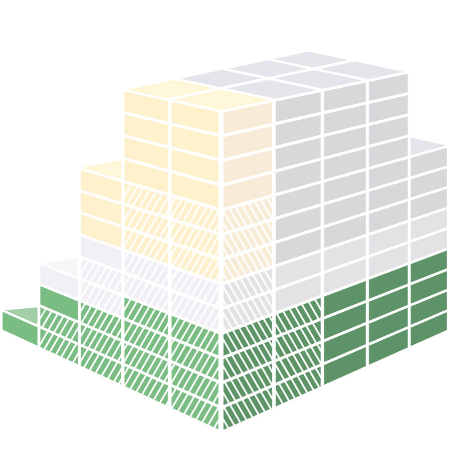
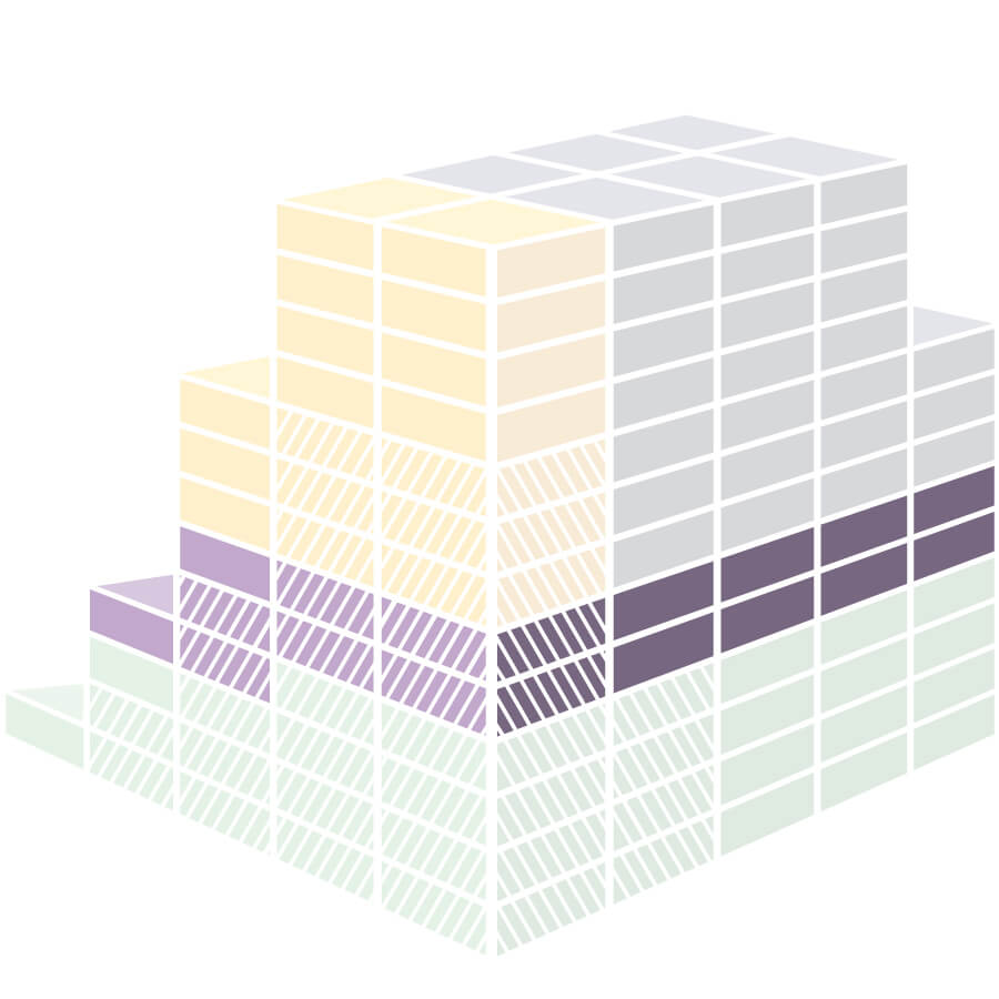
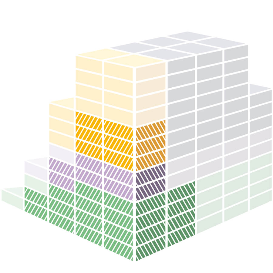 Geo base data
Geo base data forms the basis of an Urban Digital Twin of a data-sovereign city. Geo base data defines the spatial references, enables persistent, interdisciplinary relationships between different sets of information and thus creates an unambiguous interpretive space.
Specialised dataSpecialised data is application-specific data from specialist technical users. If such specialised data incorporates spatial references, it is also referred to as specialist geospatial data. This can include information on construction projects, environmental protection or demographic information.
Analyses and simulationsAnalytical tools are used to examine and interpret data. Analyses can be carried out interactively by users through visualisations or, in simulations or AI-assisted evaluation tools, their operation may be fully or partially automated.
ApplicationsApplications are the faces of Urban Digital Twins vis-à-vis customers. Data provided via interfaces is presented in visual form, suitable for human-machine interaction. Analysis components can be integrated into applications as fixed components, or they can be used as individual components (e.g. routing).
Geo base twinThe geo base twin forms the geodetic framework, i.e. the binding, authoritative basis for the spatial reference for all twin instances. It includes the intelligent networking of area-related geobase information and also takes into account the methods for data analysis. This further development at the conceptual level opens up data silos within the municipalities and renders geodata suitable for a holistic perspective.
Combining building blocks
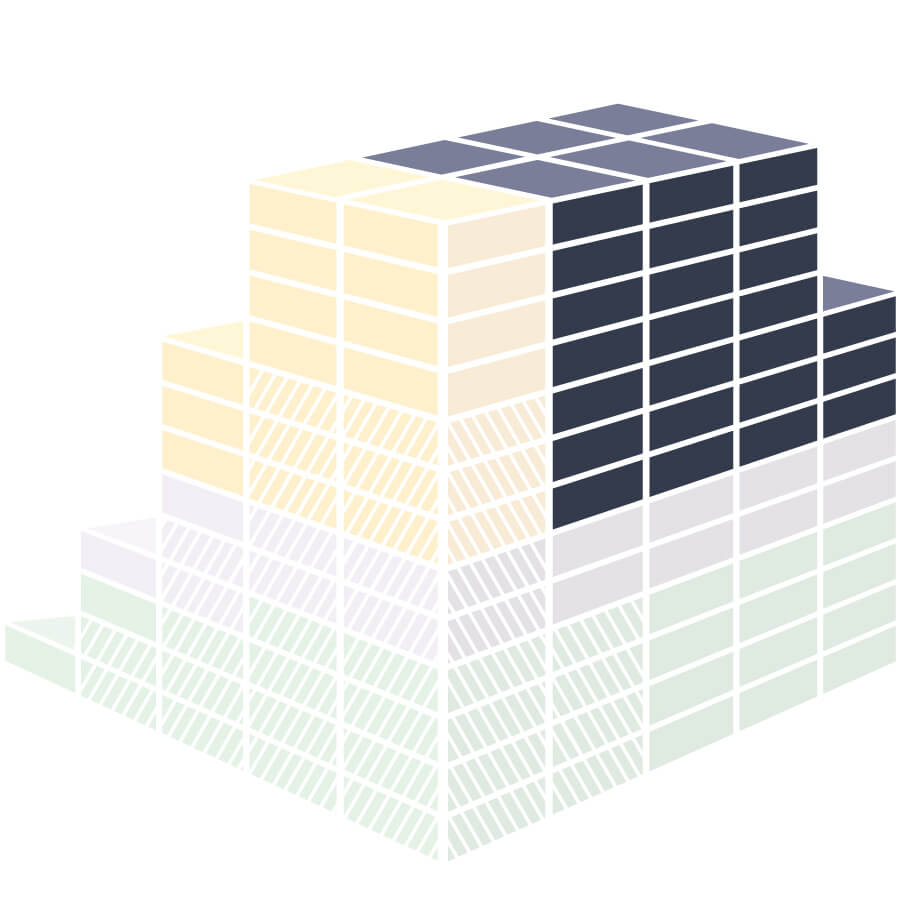
To find answers to a specific urban development issue, an Urban Digital Twin is created. The components needed to find answers are selected from the set of all the available digital resources of a municipality. The Urban Digital Twin represents the selected aspects of the real world and makes them accessible, analysable and capable of being visualised to the respective users, taking account of relevant legal requirements.
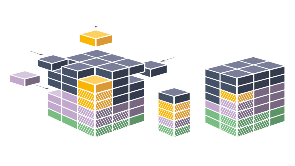
An Urban Digital Twin is created
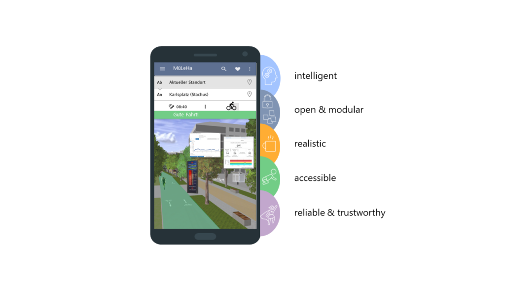
The example of routing clearly shows which building blocks must be selected from the modular system of urban resources in order to implement a navigation application that not only takes into account traffic, but also current and expected air quality.
Move your mouse over the terms below.
The example: routing

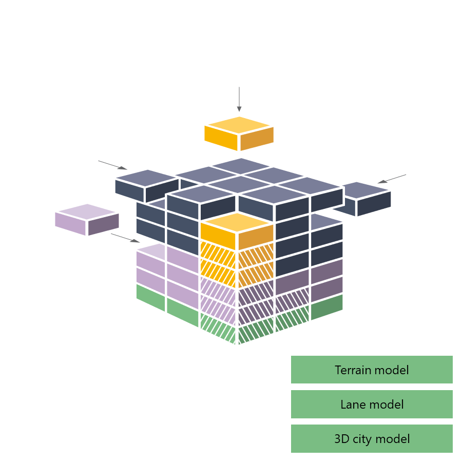

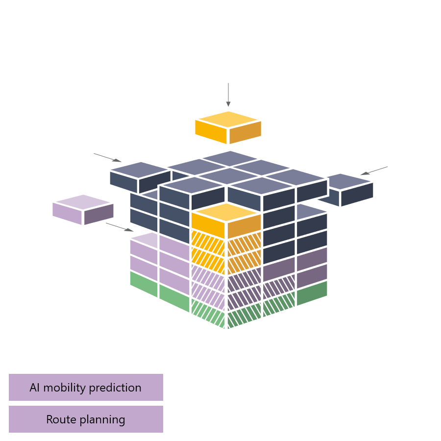
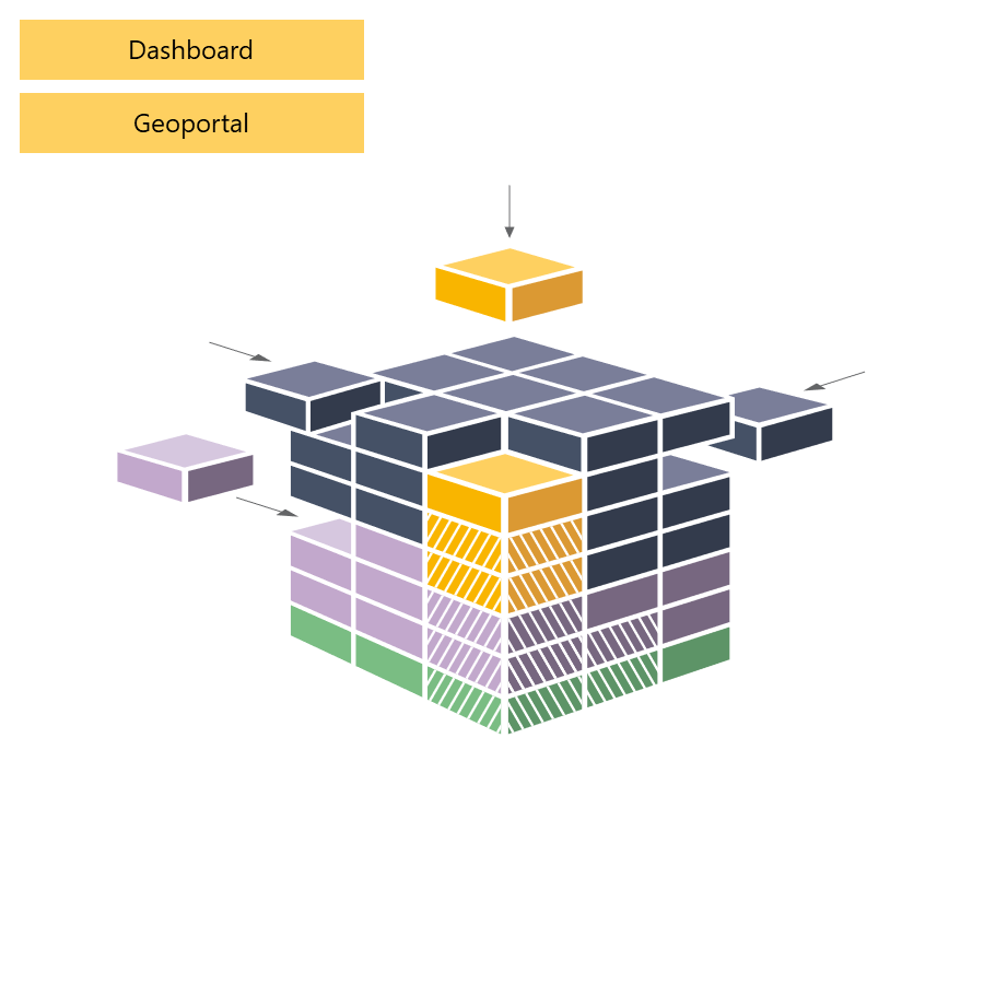 Geo base dataSpecialised dataAnalysisApplications